


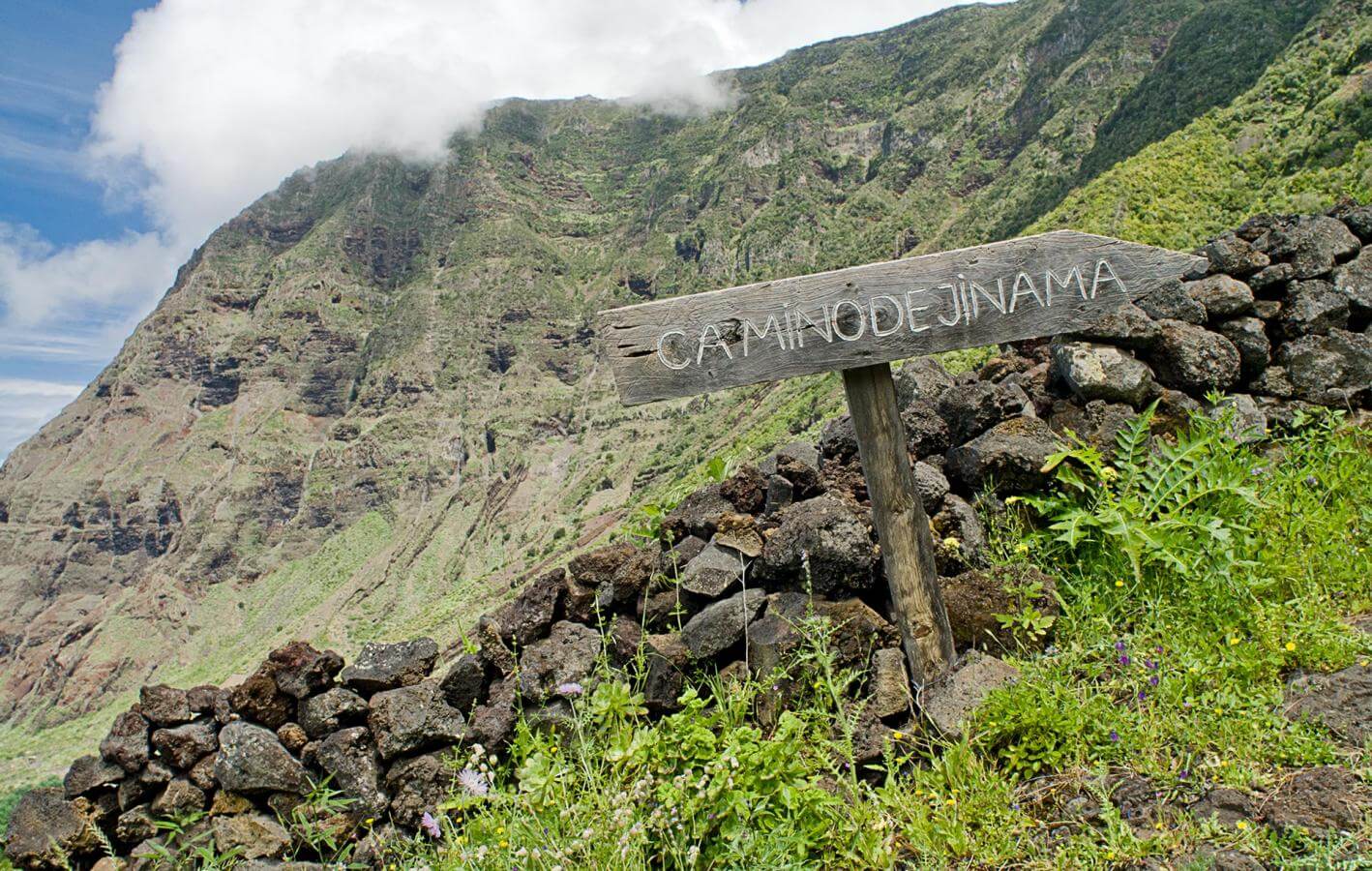
Camino de Jinama
El Hierro


This building that stands opposite the Iglesia de Candelaria church housed the first town hall of Frontera at the beginning of the 20th century. In 1912, Frontera became El Hierro's second city; until then, all institutional power hand been concentrated in Valverde.
Opposite this building, which has now been turned into a bar, you have the Iglesia de Candelaria church. The stand-out feature of this church has to be the large bell tower that is located behind the church in a small volcanic cone on the Joapira mountain. The Camino de Jianama begins here, where approximately the first 500 metres of the trail are asphalted.
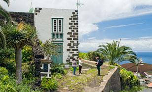
Traditional houses in El Hierro had bare stone walls as whitewash was a luxury that not many families could afford. In fact, floors were generally made of mud mixed with cow dung.
As a result, the first whitewashed house in the El Golfo valley became something of an attraction and the name Casa Blanca (White House), which it was given back in 1873, has stuck on. Located in the Los Corchos settlement, this building used to be a marker in the landscape, as it could be clearly seen even from the sea. Today, it goes more unnoticed, but it continues to reflect the quiet dignity of the traditional rural architecture of the island.
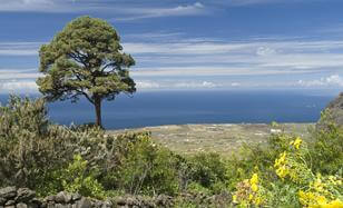
This unique pine tree is the namesake for this plot used to grow grapevines that snake their way to the edge of the public area of the forest. The tree stands out not only because of its height but also because it is outside its natural habitat which would generally be on the southern face of the summit of the island. This pine, like the others on this slope, have grown from seeds that have fallen to the ground - and germinated - in the droppings of pigeons that fly over this area.
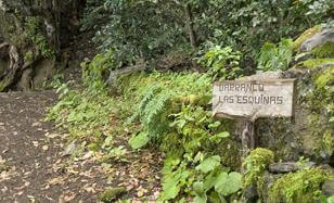
One of the five gates that was shut at night used to be here. The point of these gates was to keep animals away from the crops; the forest was public and there was livestock, especially pigs, roaming free. The gate has disappeared by you can still see where the line between the private and public part of the forest was drawn.
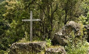
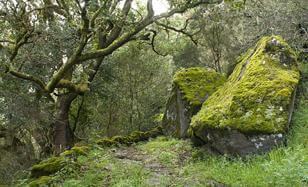
This rock along the trail looks like an altar because of its rectangular shape and the different levels, the wooden cross on the upper part and a large carving of a cross on the side.
These religious symbols are linked to its use as a place to rest for the dead. Up until the mid-19th century, those who died in El Golfo had to be taken to Valverde to be buried. This rock was used as to house the body and as a rest stop for the funeral procession before it entered the forest.
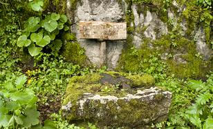
We are alongside the ravine that houses the La Helechera quarry, which supplied the red tuff used to construct the corners of many buildings in El Golfo and, of course, the Iglesia de Candelaria church. Carrying a stone for the construction of the church down from the quarry was the holy obligation of everyone using this trail.
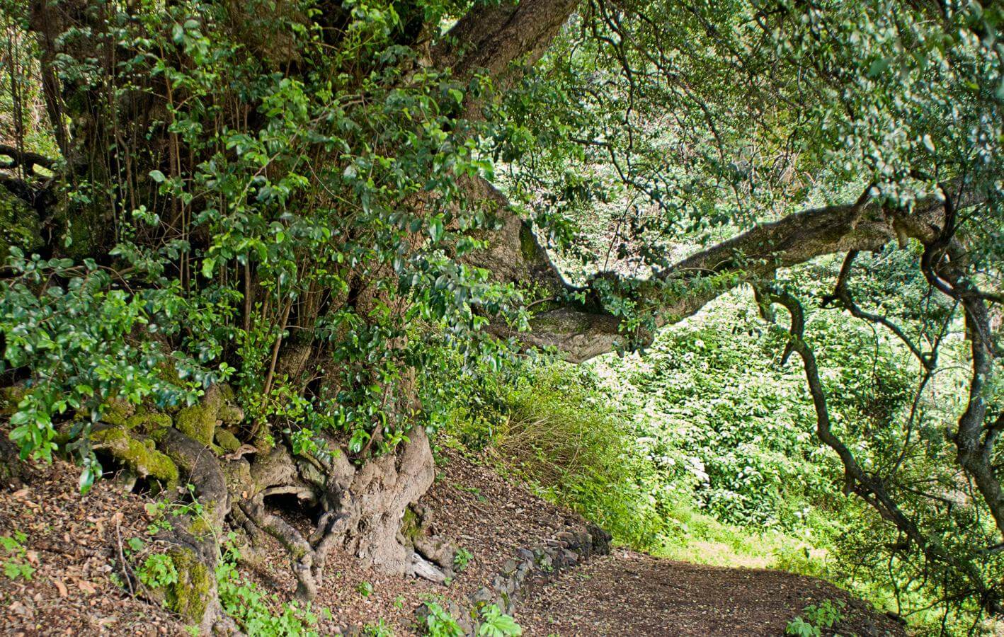
You can see a good number of barbuzano or Canary laurel trees which indicates that you are now in the humid thermophile forest found below the El Hierro laurisilva. Alongside, you also have small-leaved holly and other bush species. This forest is also called the laurisilva xérica as it can survive with less moisture and in lauraceae areas that are more developed.
This was one of the few rest stops along this trail as the area is less steep. The characteristics of this tree makes its roots the perfect place to tie up pigs during the mudada. If you look closely, you can still see tusk marks from the native species of black pig with quite large tusks that used to be found on El Hierro but has disappeared today.
As pigs would be easily spooked, they were often transported at night so that they would not be able to see the drop at the edge of the trail and accidents could thus be prevented.
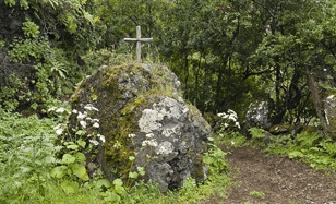
In the middle of the trail, you have this sizeable rock that resulted from a landslide and on it, a cross. Tradition says that it commemorates a friar that had an accident due to a landslide.
This rock reminds us that trails along cliffs like the Jinama trail always carry the risk of landslides, especially on days of strong winds and rain, thus making the journey dangerous.
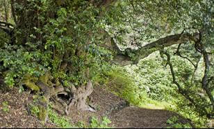
The mocán trees in Jinama are some of the best of this species found in the laurisilva. They line the trail throughout, but few are as imposing as this one in terms of size, foliage and age - it is therefore called the Mocán de la Sombra and is considered a special place of refuge for travellers.
The Mocán de la Sombra was also linked to Marian tradition as there was an image of the Virgen de la Concepción in one of the hollows of the tree trunk. This image led to the development of a celebration along this trail that also included dancers.
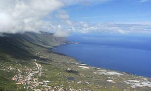
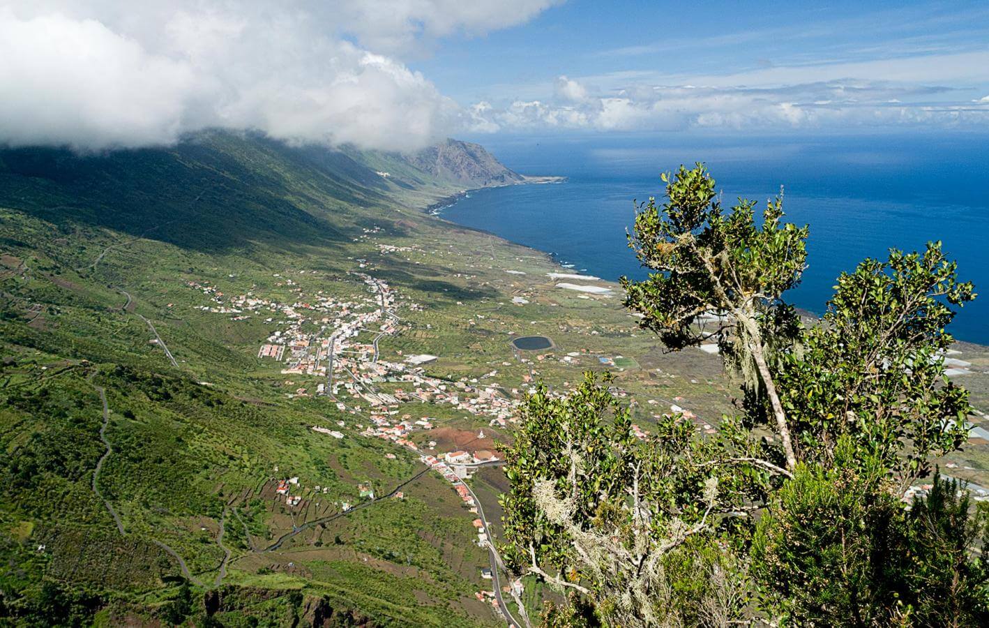
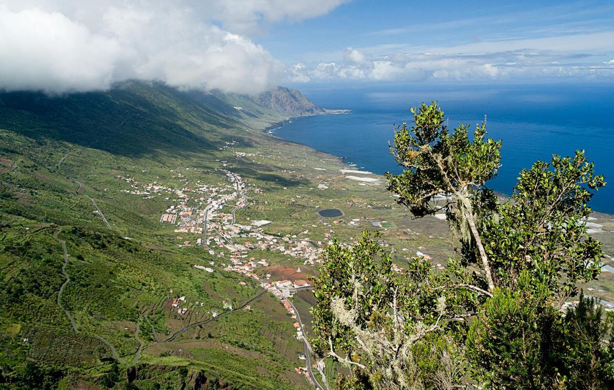
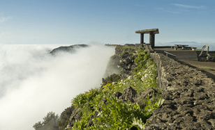
This is a natural look-out point situated above El Golfo. People called out through whistles and shouts to those climbing down to, for example, put the food on the stove or to confirm that they had arrived well. Due to very little ambient noise earlier, sound would travel even further. They also used horns made of conches and shells and each family had a signature call.
This point was also used for the margareo, which was carried out when a donkey died or was killed. Youngsters would related parts of the donkey to people they wanted to settle a score with by calling out during the night. This was a form of social critique and served as a sort of pressure valve in a small society.
Jinama also features in El Hierro's main public celebration, the Bajada or Descent of the Virgen de los Reyes where the statue travels through the different villages on the island.
The Virgen de los Reyes leaves the valley in the Descent every four years through Jinama, after reaching Valle del Golfe through the Los Roquillos tunnel and then risks the traditional La Peña trail.
500 people accompany the Virgen, forming a large procession and since 1989, take a break at this juncture. This keeps one of the traditional uses of this trail alive, even though today it has become one of the best hikes on El Hierro.
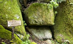
This cave along the road has some round stones inside, which look like barrels used to store wine. On the Canary Islands, these barrels are called pipas and thus the cave is also named after them. The pipa is also a traditional measurement used in agriculture on the Canary Islands and is used for irrigation, where one pipa corresponds to approximately 450 litres.
In addition, this point is important as it was a pit stop along the trail where it was possible to rest the donkey. Those who were climbing would inform those who were descending about the consitions in the valley and vice versa.
Letime is an old word from the Canary Islands that is used in Spanish to refer to a high ridge or a cliff, or even the edge of a very high ridge or precipice. In Isora, the letime is marked by the Cuchillo de Jinama, which crowns a volcanic dyke that indicates the access path to the trail that snakes through the cliff. It is a real landmark and can be seen from the beginning of the royal path in Joapira.
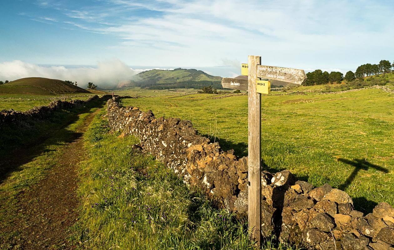
It was tradition to put oneself in the hands of a Virgin or a Saint when using one of these trails during the mudada. The three main trails, Tibataje, San Salvador and the current Jinama, have a hermitage at the beginning where one can ask for protection for the descent or give thanks after finishing the ascent. In Jinama, the hermitage is devoted to the Virgen de la Caridad. This small place of worship dates back to 1924 and was built with the help of donations from the residents of San Andrés and Isora as also from emigrants to Cuba.
The inhabitants of El Hierro have given this section of the Nisdafe plateau in this name because of a unique volcanic phenomenon. In this northern part of the plateau, the eruptions of the San Andrés volcanic formation must have been very fluid and with a substantial amount of gases, which have resulted in underground tubes and cavities at little depth.
While crossing this section on horseback, the hooves would resonate as if striking a drum, and this led to the curious name The Land that Sounds. This name is more than three centuries old and is mentioned in the chronicles of El Hierro by Bartolomé García and lends a certain magical air to this area.
- Never leave waste of any type lying around, including cigarette butts. Leftover food leads to a proliferation of rats and wild cats, which pose a serious threat to the fauna.
- Respect the animals. Do not bother them or feed them. If you see an injured specimen, you can call the emergency number: 112. Do not pick flowers or plants.
- Do not pick up or take away stones or any other item from the natural environment. And do not move them to pile them up into sadly famous 'towers'.
- Respect the signposting along trails. Leaving the set paths causes damage to the environment and could also be dangerous for you and anyone with you.
- It is safer to keep your pet on a lead.
- Try not to alter the peace of the environment with excessive noise (loud music, yelling, etc.).