Discover all 268 km2 of El Hierro covered in a unique and rich variety of landscapes.
There is a small network of good roads that will allow you to discover
As distances are short in El Hierro, wherever you arrive on the island, you are always near the other towns and tourist resorts. Los Roquillos tunnel (2,240 metres long) is a real cornerstone of insular traffic that helps keep territories closely connected.
Here you will find maps to help you explore every square metre of the island.
Road Map of El Hierro
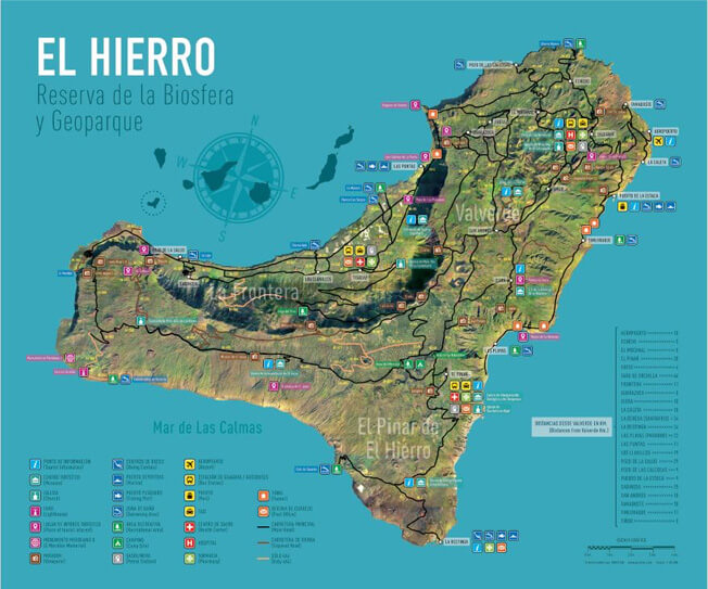
Download PDF of Road Map with general information.
Hiking Map of El Hierro
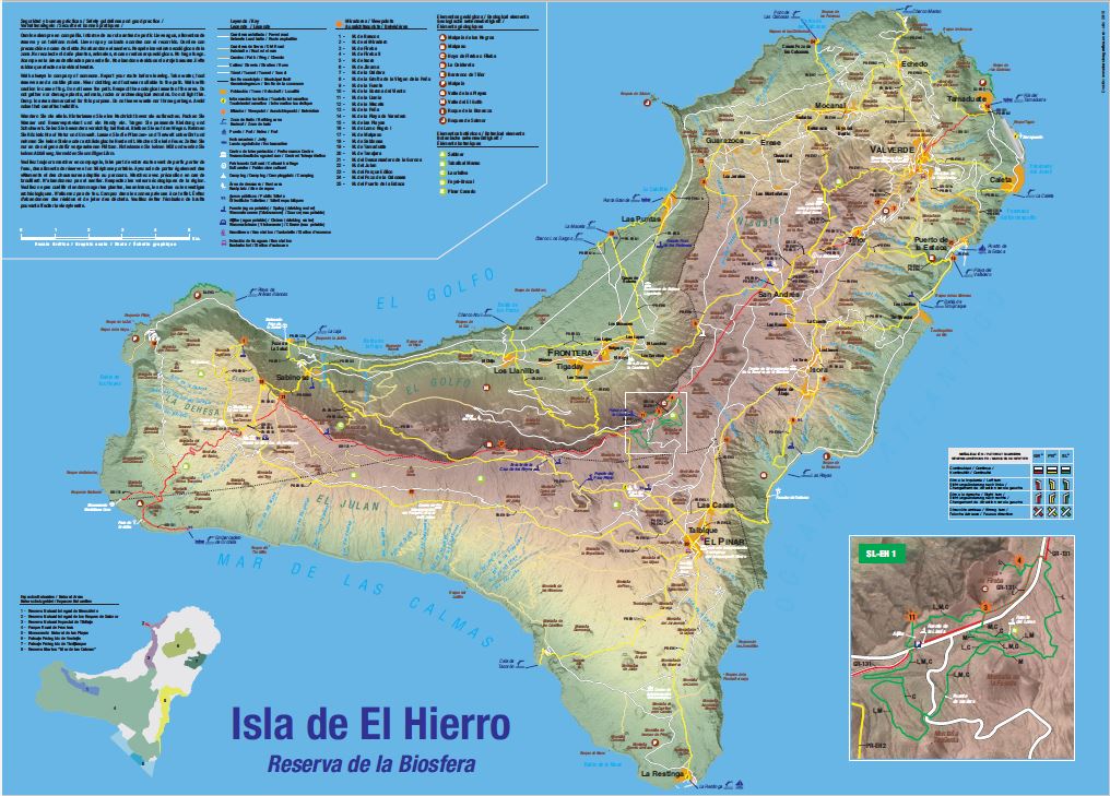
Download PDF of Hiking Map.
Route Profiles of El Hierro
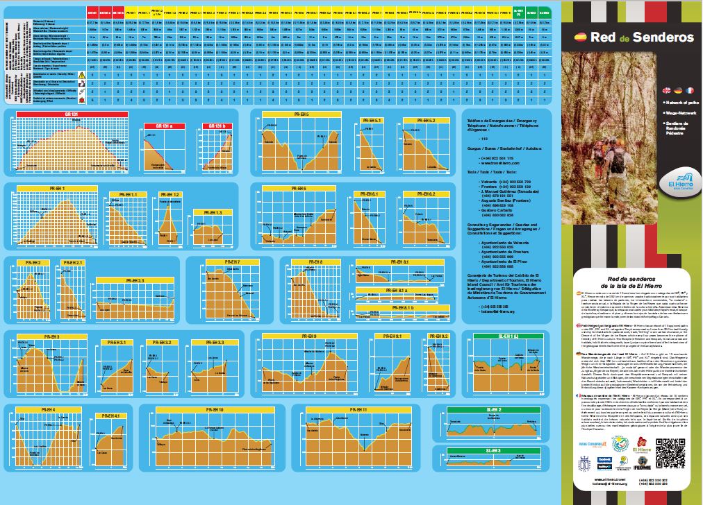
Download PDF of Hiking map with path profiles.